By Ken McEntee
Taking inventory at Atlanta-based Oldcastle Lawn & Garden's 30-plus mulch and soil yards used to require hours of manual measuring with a walking wheel and yard stick, then counting and recounting the collected data.
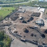
After switching to an image-based measurement system, "They are now able to walk around a stockpile with an iPhone in two to three minutes, and entire sites can be measured in 10 to 15 minutes using a drone," said David Boardman, CEO of Stockpile Reports, of Redmond, Wash., which utilizes a patented digital platform for managing inventory and tracking production based on images from the ground and air.
Labor and time spent to measure inventory was greatly reduced and the need for recounts was eliminated after Oldcastle, which does business as Jolly Gardener, implemented Stockpile Reports' system, Boardman said.
"Newly freed-up labor resources allowed Oldcastle to focus on other inventory variables such as damages, vendor shortages or quality issues, weather, compaction and processing," he said. "For the first time, Oldcastle was able to quantify volume changes of their product as it moved through the life cycle of production. Losses in inventory were accounted for and explainable to the company’s management and finance team."
Similarly, Firmatek LLC, of San Antonio, provides laser-based inventory measuring and mapping systems for landfills and for aggregate stockpiles at mines and quarries. Rob Wyssbrod, president and COO of the company, said the company also has sizable clients who sell soil, mulch and fertilizer.
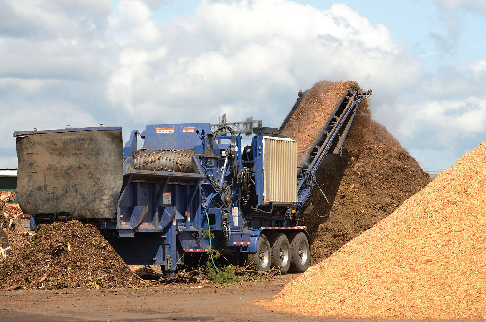
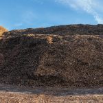
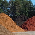
"Every business has to manage its inventory," Wyssbrod said. "In a grocery store, or at Target, you can go and count the number of boxes or soup cans. But for mines and landfills, how do you measure that? A pile is an abstract, three dimensional huge object. Using truck mounted lasers and/or drone photogrammetry, we have gotten very good at being able to scan and survey large objects like mulch piles and provide detailed reports on them."
The use of drones to fly over a mulch yard to take aerial photos has captured the attention of the curious. But capturing photos and laser images is just the beginning of the inventory management process. The real benefit of the process, Boardman and Wyssbrod agree, is derived from analyzing the data to get accurate pile volume measurements and other information.
Both Stockpile Reports and Firmatek use algorithms to convert the imagery into third-party reports and operational insights that clients can use to improve their operations.
"At our core, we're an image processing company," Boardman said. "We have Ph.D. engineers on our team writing algorithms to look at every pixel of the pictures we collect and perform analytics. Once the pictures are on our servers, algorithms process those images to do things like compute the quantity or the volume of a pile or identify risks in the pile, like if somebody left equipment on the pile, or if there's standing water around the pile. All those things can be identified by the computer automatically from those images to create a stockpile report."
Better data
Boardman said having more consistent, accurate and timely data is key to a successful operation.
"More frequent and accurate inventory measurements will expose variances in perpetual inventory before they become costly write-offs," he said.
He said frequent inventory measurement data also provides companies with actionable data to track against operational key performance indicators, such as:
- How much does the chipper really chip per hour?
- Is my vendor shorting me or sending me an inferior spec?
- How do my inventory compaction rates change through the production process due to actions such as driving over the product, moving it, coloring it, bagging it, etc.?
"Timely and accurate measurement data will provide answers to all of these questions," Boardman said. "Armed with the correct data, your production managers take steps to improving Key Performance Indicators and eliminating variances in the physical inventory."
How it works
The process begins with the collection of images.
Stockpile Reports collects digital photographs using drones, pole-mounted cameras and iPhones.
Firmatek uses LiDAR (Light Detection and Ranging) and drone aerial data to measure piles and transform aerial data into 3D models. Ground scanning can be done using LiDAR scanners mounted onto a truck.
"An optical head spins hundreds of turns per second," Wyssbrod said. "It's like a laser version of radar and it's connected to GPS. The result is a very accurate, detailed image with dozens of points per square inch."
Laser equipment also can be mounted onto drones.
Once the images are collected, whether by drone, stationery camera, iPhone or scanner, they are uploaded to the service provider for analysis. Stockpile Reports and Firmatek generate maps and reports for every pile at a yard. The client can access the information through its account on a computer.
One client's account that Boardman demonstrated revealed a property map and a listing of each of the company's 158 piles at multiple locations.
"Our system identifies the piles, their measurements and tags whether there is a issue with the pile that could impact product quality or that could impact your ability to get a good confident measurement," Boardman said. "For example, is there vegetation growing out of a pile? The photos will reveal that. You also will see a 3D image of the pile. So the person overseeing 180 stockpiles walking the yard and keeping his data on his whiteboard can now send a drone out every day and get fresh numbers on all those piles every day and have complete reports at his fingertips."
State of the industry
The mulch and soil industry, Boardman said, is the most complicated and complex business Stockpile Reports is involved in.
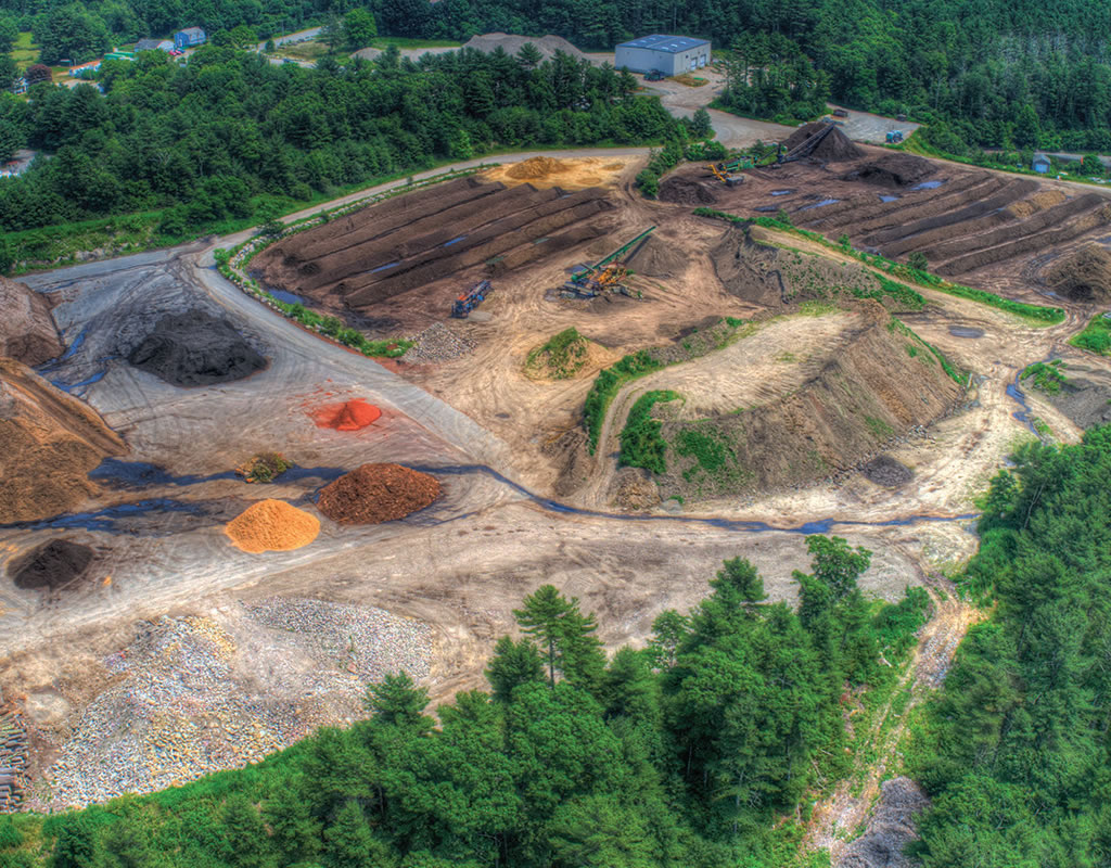
"Landscape materials facilities tend to have many more stockpiles on hand at any given site than our other industries," he said. "Typically there's one person trying to figure out how to build all the right piles, how to age them for the right number of days, how to make sure they're the right dye colors, make sure they don't get contaminated and how they're all going to show up at this little processing facility and go into three bagging lines and making sure they end up on a truck on a certain date. The amount of planning is just phenomenal. The person who is doing all that, I view them almost as a chef. They've got their recipe, they've got everything written on whiteboards or maybe a spreadsheet, or maybe it's just in their head that they're keeping track of all this. In some cases, companies are using walking wheels and estimating the height of 150 different piles. It's just not good enough data when you can do something that is a lot easier and far more accurate."
Must landscape materials companies that are starting to use image-based inventory management today are just getting comfortable doing inventory counts to reduce financial fluctuations, Boardman said. But, he said, that is just scratching the surface of the data that is available.
"Traditional drone flights do a great job of replacing a manual walking wheel or tape measure with a digital one, but these measurements are just a snapshot of your business and thus, little data," Boardman said. "Big data tells a more complete story and fills in the gaps. Oldcastle found that they weren’t necessarily losing inventory, it was just being compacted or the load may not have been what was expected on the invoice. With big data, they can track how much is lost or gained due to processing, compaction rates, vendor deliveries, etc. 'What ifs' can also be researched, such as what’s the optimum aging amount and what’s the ideal storage procedure. A user can track densities by plant, region or season, such as a wet winter vs. a dry summer."
The frequency of collecting data with digital imagery can vary from company to company, Boardman said. For example, a yard might fly a drone-mounted camera over its yard once a year to prepare for end-of-year inventory reporting. Or it may do monthly or weekly fly-overs to record current conditions.
"In addition, some companies will use an iPhone to take photos whenever a delivery takes place," Boardman said. "Or maybe they just turned a pile and they're trying to understand what's the compaction impact of these processes. They might run out there with an iPhone and grab a quick measurement, or they might click a button and have a drone pilot show up and fly. The measurement activity really tends to increase the longer the customer subscribes to our service."
Wyssbrod said Firmatek offers several different drone-based collection programs to its clients:
- The customer can fly its own drone and upload the data to the "Firmatek cloud."
- The customer can lease a drone from Firmatek to fly itself.
- Firmatek can fly the drone.
The advantage to the client flying the drone is flexibility.
"A drone is dependent upon weather and wind," Wyssbrod said.
Being able to choose to fly or not fly, depending on the weather, is more convenient than having to cancel and reschedule a Firmatek flight when bad weather hits.
The advantage to Firmatek flying the drone and capturing the data is the expertise involved, which could result in better accuracy, Wyssbrod said.
"If you want to fly your own drone, then send your data to Firmatek, we've found that you really do need to have somebody dedicated - preferably at least two people - who are well trained and know how to fly the drone and collect the data properly," he said. "A main issue laying out control points that the drone can use as reference points in its images. If you buy your own drone it needs to have what's called RTK, or Real-Time Kinematics (a satellite navigation technique used to enhance the precision of position data derived from satellite-based positioning systems). Accuracy is important in data collection - you can imagine on that a 100 foot long pile, a six-inch error in height will make a difference of scores more or less cubic yards of material than you really have."
A massive change
Boardman said subscriptions to Stockpile Reports are sold based on the number of piles a company is managing.
"This is a massive change for the industry," he said. "It's going from basically doing your best and flying blind to actually having data at your fingertips."
Ken McEntee is editor and publisher of Composting News (compostingnews.com).
Related News
Subscribe Today
Every other month, Soil & Mulch Producer
News brings you important stories about:
• New Technology
• Products
• Industry News
• Research Studies
Soil & Mulch Producer News features articles and services relevant to your daily operations.
Subscribe