By P.J. Heller
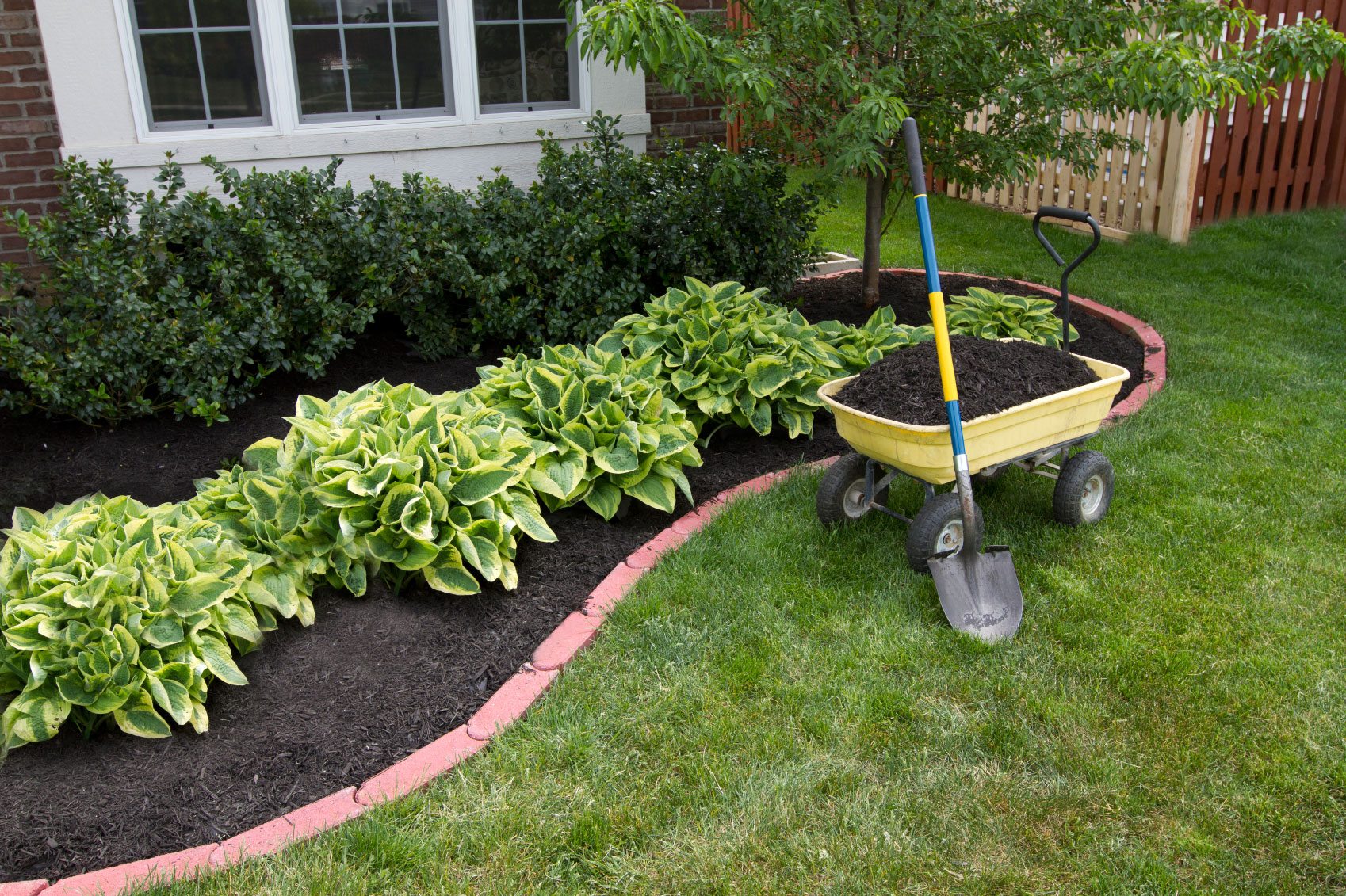
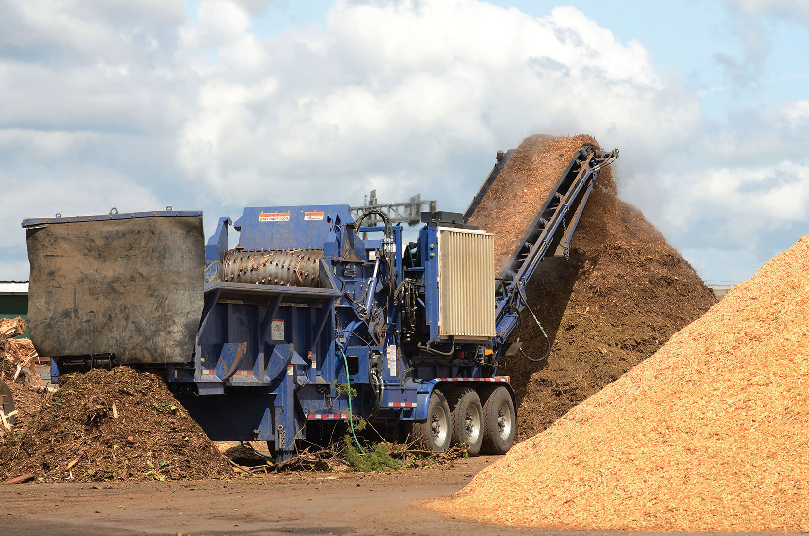
Soil, mulch and compost producers may soon be flying high, launching drones with sophisticated software to quickly and cost-effectively measure inventory, map their areas and improve safety.
Used by both military and civilians, the latter primarily for aerial photography and videography, drones -- or unmanned aerial vehicles or unmanned aircraft systems -- are increasingly finding their way into commercial usage by surveying, aggregate and mining companies, news organizations, paper manufacturers and emergency responders, among others.
“I don’t think there is a better example of changing times than what we’re seeing with drones,” said Federal Aviation Administration administrator Michael Huerta. “They’re being used in so many industries like filmmaking, agriculture, search and rescue operations, inspections of rail tracks and pipelines, and many others.
“We are only beginning to see some of the ingenious uses of new and miniaturized technologies developed for drones,” he told an Air Traffic Control Association conference in a keynote speech.
Globally, consumer drone sales are expected to quadruple over the next five years, with revenues increasing from $8 billion to more than $12 billion, according to Business Insider. “Growth in the enterprise sector will outpace the consumer sector in both shipments and revenues as regulations open up new use cases in the U.S. and EU, the two biggest potential markets for enterprise drones,” it reports.
The FAA estimates the number of drone operators-for-hire may exceed the nation’s 171,000 private pilots within a year.
Drone technology was on display and discussed at the Mulch and Soil Council’s annual meeting in October as the industry explored how it can benefit from its use. Among the conference speakers was Lauren Elmore of Firmatek in San Antonio, Texas, who discussed drone solutions and 3-D mapping for inventory control.
“Drone solutions make it easier to collect data, and therefore can help you manage you inventory better,” says Elmore, president and co-owner of Firmatek, which provides stockpile measurement, inventory management and mapping services to a variety of industries. “With drones it’s become so much easier to capture the data and much more cost-effective for clients to capture the data.”
Drone technology is also significantly faster for mapping inventory piles, cutting the time from weeks or months to hours, she says.
Lewis Graham, president and chief technology officer at GeoCue Group in Madison, Ala., agrees that drones offer substantial benefits to businesses such as mulch and soil manufacturers.
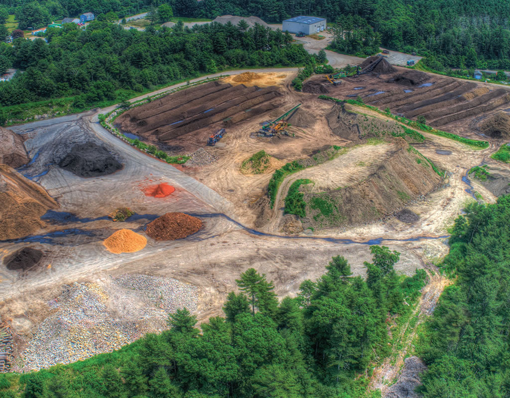
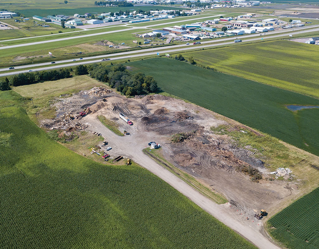
“Any industry that stockpiles inventory in uncovered locations is a candidate for drone-based inventory tracking,” he says.
“It’s really an enabling technology, something that wasn’t available before,” says Graham, whose company and its subsidiary, AirGon, provide tools for airborne and mobile laser scanning as well as technology for drone collected stockpile volumetrics and mine site mapping.
“Drone mapping technology offers a fast and efficient way to measure/map areas that are predominately non-vegetated,” he says, adding that drones can “see” the tops of tall or inverted piles, providing more accurate measurements.
Both Elmore and Graham say drones offer numerous other advantages for soil and mulch companies.
“Without a doubt, safety is improved,” Graham insists. “No need for surveyors to spend extended periods of time moving around equipment such as trucks and loaders. Of course, it also removes the need to climb or walk on piles.”
Elmore concurs.
“One of the points I like to bring up about drones is it makes it much safer to collect the data than it ever has been in the past,” she says. “You don't have to walk on piles . . . You can stand pretty far away and go fly it and not have to worry about being in the way of any trucks coming in or out. It makes it much safer.”
Drones can also be equipped with an infrared (IR) camera, which can detect hot spots at mulch and compost facilities, potentially averting fires caused by spontaneous combustion.
“By placing dual cameras on the drone (visible and IR), the flights could be dual purpose: inventory and hot spot detection,” Graham says.
Mulch and soil producers have several options when it comes to utilizing a drone. They can purchase or lease a complete system consisting of the drone and software; buy their own drone and software with data processing provided either by themselves or by companies such as Firmatek or AirGon, or can arrange for a service provider to handle the entire flying, software, and data processing operations.
The additional cost of utilizing an outside service provider to do everything could partially be offset by having more frequent surveys and more accurate figures, Elmore notes. Even so, the cost of gathering and processing data is so cost-effective that “there’s really not a reason why people cannot start using this technology. It makes a lot of sense for producers of soil and mulch . . .” she says.
“For those who decide they want to do the measurement work internally, drones are an excellent choice since the entire process can be learned in a few days and the complete kit, especially when using a low cost drone such as a DJI Inspire, is affordable,” Graham adds. “Somebody who owns their own business can buy a drone and software and learn how to use it pretty quickly and go do their own volumetrics. That makes it a lot handier to do monthly surveys instead of every six months.”
The technology has made surveying much less expensive than it has been in the past, Graham says.
“It’s reduced the cost of doing the surveys and also made it accessible to owner-operators. I don't have to call in an expert anymore. I can do it myself and that lowers the cost and raises the convenience,” he explains.
Consumer drones, such as the Phantom 4, Phantom 4 Pro or Mavic Pro from DJI are all suitable for survey purposes. They range in price from just under $1,000 to about $1,500. Total packages, including a drone and software, for volumetric mapping and contour mapping can run $10,000 and up, depending on the number of sites to be surveyed and number of deliverables required.
“We prefer the idea of combining competent software with a low cost drone such as a DJI Phantom or Inspire as a better approach to getting started,” Graham says.
Among AirGon’s offerings is a Bring Your Own Drone (BYOD) Mapping Kit that includes all the software necessary for programming a drone to follow a mapping collection flight plan, the software for generating point clouds and ortho images as well as the analytic software for extracting information such as volumes. The kit costs $7,990.
“Thus for $10,000 to $12,000 you have a complete mapping/volumetrics system,” Graham says.
Firmatek tailors its packages to its clients, offerings both a complete system or just software and processing services. Typical turnaround after data is uploaded to Firmatek is 48 hours or less.
Businesses wanting to fly their own drones need to be aware of FAA regulations, as well as any potential state or local regulations.
The FAA in June announced rules making it easier for companies to use drones for commercial purposes. Those rules require an operator to be at least 16 years of age, to pass a written test at an FAA testing facility and to pass a security background check conducted by the TSA. There are numerous courses available to help people pass the written test.
“Our experience has shown that a person with no prior knowledge can pass this exam with about 12 hours of preparation time,” Graham says.
“It’s very easy to do, then you can legally fly your drone,” Elmore adds.
The rules require ta drone to weigh less than 55 pounds and to be registered with the FAA, which can be done online. (More than half a million drones have been registered as of October, according to the agency). Other rules limit drones to a maximum altitude of 400 feet, to be flown only during the day and they must remain within the visual line-of-sight of the operator.
“The drone operator has to follow all [FAA] Part 107 rules,” Graham says. “For inventory management over private sites, these seldom present any barriers.”
Elmore says learning to fly a drone and collect data is so simple “you could teach a child to do it.
“We go out and show somebody a couple of times how we do it, maybe two or three times. We let them do it a couple of times and then we’re off . . . It’s pretty foolproof, actually. There’s really not much you can do wrong as long as the hardware and software are working correctly. It’s very, very easy to use.”
Related News


Subscribe Today
Every other month, Soil & Mulch Producer
News brings you important stories about:
• New Technology
• Products
• Industry News
• Research Studies
Soil & Mulch Producer News features articles and services relevant to your daily operations.
Subscribe